
Published October 3, 2026
Brookswood and Fernridge: Big Lots, Big Trees, and the Rezoning Question
Written by Rob Visnjak, Personal Real Estate Corporation | Oakwyn Realty Ltd. | Published October 3, 2026
Brookswood, Langley is the Township’s south end: big lots, tall conifers, and a Community Plan that has been rewritten more than once. Fernridge sits with it in the same plan area. If you’re weighing a move here, the questions that matter are how big the lots really are, what the Township has actually decided on rezoning, what provincial small-scale multi-unit housing rules mean on a large lot, and what homes cost. Here’s what the official numbers and plans say, and where they stop.
Brookswood and Fernridge, Langley at a glance
Brookswood-Fernridge is in the Township of Langley, not the City of Langley. It sits south of the City of Langley, east of Surrey, with Campbell Valley Regional Park and Agricultural Land Reserve land along parts of its edge. The two Langley municipalities have separate councils and tax rates. More on that in Langley City vs Langley Township.
| Measure | Figure | Source |
|---|---|---|
| Township estimate, 2021 | 13,882 | Township of Langley |
| Township estimate, 2025 | 14,825 | Township of Langley |
| Change, 2021 to 2025 | +943 (+6.8%) | Calculated from Township figures |
| Township of Langley total, 2025 estimate | 157,831 | Township of Langley |
| Community Plan area | About 1,440 ha (3,558 acres) | Brookswood-Fernridge Community Plan |
| Planned population at build-out (plan) | About 59,900 | Brookswood-Fernridge Community Plan |
| Public park space (plan inventory) | About 46.5 ha (115 acres) | Brookswood-Fernridge Community Plan |
Sources: Township of Langley population estimates by community as of January 1, 2026, published January 31, 2026 (Langley Today / Mayor Eric Woodward); Township of Langley, Brookswood-Fernridge Community Plan (consolidated, Bylaw 2017 No. 5300 as amended). Percent change calculated from the Township figures. The plan’s build-out figure is a planning projection, not a census count.
The takeaway: Brookswood-Fernridge grew by under a thousand people between 2021 and 2025 on the Township’s count. Willoughby & Willowbrook added about 12,700 over the same years. The Community Plan still anticipates a much larger build-out if the new neighbourhoods fill in as mapped. So the quiet streets and large lots you see today are not the whole story the Township has written down.
Big lots, big trees, and everyday amenities
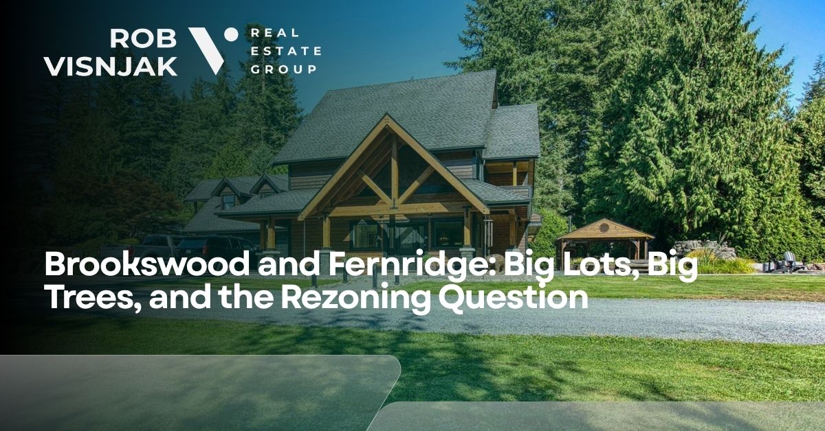
The Township’s community page and the Community Plan describe Brookswood-Fernridge as mostly single-family housing with substantial parkland, trees and conservation areas. Historically, much of the developed north (what the plan calls Traditional Brookswood) was built on lots around 650 m² to 930 m² (about 7,000 to 10,000 sq ft), often from the late 1960s through the mid-1990s. South of that, larger suburban lots and rural parcels remain part of the plan area.
The Township lists these public facilities for the area:
- Brookswood Library, 20045 – 40 Avenue
- George Preston Recreation Centre, 20699 – 42 Avenue
- Fire Hall 5 – Brookswood, 20355 – 32 Avenue
- Murrayville (Main) RCMP Detachment, 102-4059 – 200 Street (closest detachment listed for the community)
The Community Plan’s open-space inventory includes parks such as Noel Booth Community Park, Brookswood Park, Bell Park, Dale Ball Passive Park, Wiser Natural Park and the Brookswood Skateboard Park, among others. Campbell Valley Regional Park sits next door.
What I can’t give you from an official source is a street-by-street feel: which cul-de-sacs stay quiet, where construction noise is already a factor, or which pockets still sit on septic. That’s worth checking lot by lot, and seeing in person at the times you’d actually be home.
Already own in Brookswood or Fernridge and thinking about a move? Start with a number. Get my free home value estimate.
The rezoning question: what the Township has decided
You can’t talk about Brookswood without the Community Plan. Here is the sequence from Township documents, not from marketing copy.
| Date | What Council did | Source |
|---|---|---|
| October 23, 2017 | Adopted the Brookswood-Fernridge Community Plan (Bylaw 2017 No. 5300) | Consolidated BFCP |
| July 24, 2023 | Adopted neighbourhood plans for Booth, Fernridge and Rinn (later amended) | Consolidated BFCP amendment table |
| June 10, 2024 | Adopted Bylaw 6007 (SSMUH updates) and updated Booth, Fernridge and Rinn neighbourhood plans (Bylaws 6008–6010) | Consolidated BFCP |
| January 27, 2025 | Fernridge Crescent Area amendment (Bylaw 6057) | Consolidated BFCP |
| May 25, 2026 | Adopted Bylaw 6210 (BFCP Update 2026) | Consolidated BFCP |
The plan area covers roughly 1,440 hectares from about 44 Avenue to 16 Avenue and from 196 Street to east of 212 Street. It organizes growth around community and neighbourhood centres, with commercial village designations in places such as near 200 Street and 40 Avenue (Brookswood Village) and in the newer neighbourhood centres.
At build-out, the Land Use Plan anticipates about 59,900 people. Approximate neighbourhood build-out figures in the plan are:
| Neighbourhood (plan) | Approximate build-out population |
|---|---|
| Booth | 18,500 |
| Fernridge | 10,000 |
| Rinn | 8,000 |
| Glenwood | 3,600 |
Source: Township of Langley, Brookswood-Fernridge Community Plan, Section 4 (Land Use), consolidated version including Bylaw 6210.
Important nuance: a Community Plan designation is not the same as a finished rezoning. Large parts of Brookswood-Fernridge are still zoned for lower-density residential uses until a rezoning and subdivision application is approved. Development depends on servicing (water, sewer, storm), development cost charges, greenway and amenity requirements, and the usual permit path. The plan itself says rezonings are part of implementation.
What the residential designations allow, in plain terms (always check the map for a specific lot):
| Designation | Minimum lot size (plan) | Units (plan policy) |
|---|---|---|
| Single Family 1 | 0.8 ha (2 acres), with limited exceptions | Single family |
| SSMUH 1 | 3,716 m² (40,000 sq ft) | Up to 4 dwelling units, including secondary suites |
| SSMUH 2 | 650 m² (7,000 sq ft) in Booth, Fernridge, Rinn and Glenwood NP areas; 930 m² (10,000 sq ft) elsewhere in the plan | Up to 4 dwelling units, including secondary suites |
| SSMUH 3 | 465 m² (5,000 sq ft) | Up to 4 dwelling units, including secondary suites |
| Traditional Brookswood | 929 m² (10,000 sq ft) minimum; SSMUH required by provincial legislation where conditions are met | Up to 4 units where municipal water and sewer serve the property, with fees and permits |
| Rowhouse / Townhouse | Compact lots / up to 20 units per acre for townhouses (plan) | Rowhouses and townhouses in designated centres |
| Apartment | FSR-based; up to 6 storeys in plan policies for designated apartment sites | Low-rise apartments in centres |
Source: Brookswood-Fernridge Community Plan, Sections 4.2–4.9 and 4.7 (Traditional Brookswood), as consolidated. This is land-use policy, not legal advice and not a substitute for a zoning confirmation on a specific address.
So the honest answer to “is Brookswood being rezoned?” is: the Township has adopted a community plan and neighbourhood plans that allow denser forms in mapped areas, aligned those plans with provincial SSMUH rules in 2024, and updated the community plan again in May 2026. Individual lots still need to follow zoning, servicing and permit rules. Some applications are already moving through Council under those plans; that does not mean every large lot is about to become a townhouse site.
What SSMUH (Bill 44) means on a large Brookswood lot
Provincial housing legislation (often called Bill 44) required municipalities to permit small-scale multi-unit housing on many restricted residential lots. The Township updated the Brookswood-Fernridge plans for that on June 10, 2024. For how the rules work across Langley, see what Bill 44 means in Langley and secondary suite rules in Langley.
In short, for buyers and owners here:
- On many eligible lots, the provincial floor is 3 units on smaller parcels and 4 units on larger ones (within the size bands the Local Government Act sets). That can include a house with suites, duplexes, triplexes or fourplexes, depending on zoning and permits.
- In Brookswood-Fernridge, the Community Plan layers its own minimum lot sizes and SSMUH 1 / 2 / 3 designations on top of that. A 10,000 sq ft Traditional Brookswood lot is not automatically a fourplex the day you buy it. Water, sewer, fees, development permits and building permits still matter. The plan says Traditional Brookswood properties must be serviced by municipal water and municipal sewer before SSMUH forms proceed that way.
- Larger lots can look like redevelopment candidates on a map and still be constrained by trees, aquifer protection, streamside setbacks, lane requirements or neighbourhood design rules.
- This article is not legal advice. Confirm zoning and permits with the Township before you price a lot as “fourplex land.”
Want to walk through a specific Brookswood or Fernridge address against the plan map? Book a no-pressure chat with Rob.
Schools in Brookswood-Fernridge (SD35)
Schools are run by the Langley School District (SD35). The Community Plan and SD35 catchment materials point to these public schools serving streets in or next to Brookswood-Fernridge:
| School | Type | Grades (SD35, 2026 brochure where listed) | Note |
|---|---|---|---|
| Belmont Elementary | Elementary | K–7 | On 40 Avenue; listed in BFCP and SD35 catchment maps |
| Noel Booth Elementary | Elementary | K–7 | On 35 Avenue; listed in BFCP and SD35 catchment maps |
| Glenwood Elementary | Elementary | Confirm with SD35 | On 24 Avenue; listed in BFCP and SD35 catchment maps; not in the 2026 district brochure excerpt used for grades |
| Brookswood Secondary | Secondary | 8–12 | On 37A Avenue / 208 Street area; SD35 lists French Immersion among programs |
| Langley Fundamental Middle & Secondary | Middle & Secondary | 8–12 | On 212 Street; district fundamental program — confirm eligibility with SD35 |
Sources: Township of Langley Brookswood-Fernridge Community Plan (existing schools list); Langley School District (SD35) catchment maps and 2026 district brochure, accessed October 14, 2026. Alice Brown Elementary sits just north of the plan area in the City of Langley; do not assume a Township address feeds it. Catchments change; proximity is not the only factor.
A few honest notes:
- I don’t rank schools. Online ratings aren’t from SD35, and I don’t use them here.
- Check the exact address. Use the SD35 School Locator, or call the board office at 604-534-7891, before you write an offer.
- French Immersion and other programs have their own entry rules. Ask SD35; don’t assume the nearest school offers the program you want.
What homes cost in Brookswood
The short version: there’s no official Brookswood benchmark price. FVREB reports Langley as one area (City and Township together). Its public release doesn’t split out Brookswood or Fernridge. The figures below are Langley-wide. A Brookswood home on a large lot can sit well above the detached benchmark; a smaller or older resale can sit below it.
| Langley-wide, September 2026 | MLS® HPI benchmark | Change vs Sep 2025 | Median sale price | Sales | Active listings | Sales-to-active |
|---|---|---|---|---|---|---|
| Detached | $1,471,100 | -6.7% | $1,345,000 | 64 | 449 | 14.3% |
| Townhouse | $802,600 | -4.4% | $795,000 | 61 | 283 | 21.6% |
| Apartment/condo | $525,900 | -9.2% | $480,000 | 67 | 416 | 16.1% |
| All types (composite) | $941,800 | -6.2% | n/a | 192 | 1,148 | 16.7% |
Source: Fraser Valley Real Estate Board, MLS® Summary and MLS® Home Price Index, September 2026 (Package202609). Langley area, all of Langley City and Township; not Brookswood alone. Sales-to-active ratios are calculated from FVREB figures. The benchmark describes a typical home, not any particular property, and isn’t a forecast.
How to read that for this neighbourhood:
- Detached still dominates the local stock, so the Langley detached line is the closest public benchmark — but it isn’t a Brookswood price.
- Townhouses were the most contested type Langley-wide (21.6% sales-to-active in September 2026). That matters as row/townhouse designations in the plan start to deliver new product. For how new vs resale differs, see new homes vs resale in Langley.
- Over 12 months (October 2025 to September 2026), Langley’s detached sales-to-active ratio ranged from 12.2% to 19.1%. Townhouses ranged from 18.0% to 30.8%. Condos ranged from 10.7% to 17.9%.
For Brookswood itself, ask for recent sold data for the exact pocket, lot size and home type. I can pull that for you. For the wider picture, see average home price in Langley and my Langley market update.
Brookswood vs Willoughby (and Walnut Grove)
| Brookswood-Fernridge | Willoughby & Willowbrook | Walnut Grove | |
|---|---|---|---|
| Township estimate, 2021 | 13,882 | 46,669 | 25,688 |
| Township estimate, 2025 | 14,825 | 59,376 | 25,741 |
| Change, 2021 to 2025 | +6.8% | +27.2% | +0.2% |
| Plan story | Large lots; Community Plan + SSMUH; long build-out to ~59,900 | Fastest growth; ~half built out | Mostly built out; little population change |
| Typical buyer question | Lot size, trees, rezoning next door | Construction, schools, SkyTrain timing | Schools, resale streets, stability |
Sources: Township of Langley population estimates (published January 31, 2026); Brookswood-Fernridge Community Plan build-out figure; Willoughby comparison themes from Township Willoughby planning materials summarized in prior guides. Percent change calculated from Township figures.
Brookswood suits buyers who want space and tree cover and who are willing to study the plan map before they buy next to a growth node. Willoughby has more new construction and a different growth pace. Walnut Grove is the steadier north-of-Highway-1 alternative. Compare areas in best neighbourhoods in Langley, or read the live Willoughby and Walnut Grove guides.
FAQ
Is Brookswood in Langley City or Langley Township? The Township of Langley. Fernridge is in the same Community Plan area.
How many people live in Brookswood-Fernridge? The Township’s estimate was 14,825 for 2025, up from 13,882 in 2021.
Is Brookswood being rezoned? The Township has adopted and updated the Brookswood-Fernridge Community Plan and neighbourhood plans (including SSMUH alignment in 2024 and Bylaw 6210 in May 2026). That sets land-use policy. Individual properties still need zoning, servicing and permits before denser forms can be built.
What high school serves Brookswood? Brookswood Secondary (grades 8–12) serves much of the area. Confirm any address with the SD35 School Locator.
What’s the average home price in Brookswood? FVREB doesn’t publish one. Langley-wide, the September 2026 benchmark was $1,471,100 for detached, $802,600 for townhouses and $525,900 for condos.
Conclusion
Brookswood and Fernridge still read as large-lot, tree-covered parts of south Langley — and the Township’s own population counts show only modest growth so far. The Community Plan, though, maps a much larger build-out, with SSMUH designations, centres and apartment/townhouse nodes in specific places. Provincial housing rules add more unit potential on many eligible lots, especially where water and sewer are in place. None of that makes a given street a good or bad buy. It means you should check the designation on the lot beside you, the servicing, the school catchment and recent solds before you offer.
What happens next: When you book a chat, we go over your budget, the pockets of Brookswood or Fernridge you’re looking at and your timing. Then I pull recent sold and active listings for that home type and we look at what’s planned nearby. There’s no cost and no obligation. Book a no-pressure chat with Rob.
This article is general information based on publicly available data as of October 2026. It isn’t financial, legal, or tax advice, and it isn’t an appraisal. Land-use plans, zoning, school catchments and housing rules are set by the Township of Langley, the Langley School District and the Province of B.C., and can change; confirm before you buy. For advice on your situation, talk to a licensed professional. Rob Visnjak Personal Real Estate Corporation, Oakwyn Realty Ltd.
Rob Visnjak Personal Real Estate Corp
Team Lead | ROB VISNJAK REAL ESTATE GROUP
or another way