
Published September 27, 2026
What SkyTrain Means for Langley Property Values Before It Opens

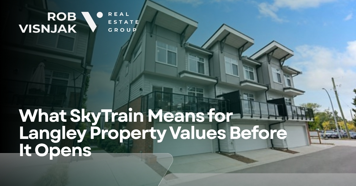
Langley property values near the new SkyTrain are already moving, three years before the first train. The premium is not waiting for late-2029 service. It is forming now around two stations: Willowbrook in the Township of Langley and Langley City Centre in the City of Langley.
The line is no longer a drawing on a plan. The Province renamed the 16-kilometre Expo Line extension the Dave Barrett Extension. It runs from King George Station in Surrey to Langley City Centre, adds eight stations, and is budgeted at $5.996 billion. Official materials target service in late 2029, with opening-year weekday ridership of about 56,000 rising toward 80,000 by 2050.
Travel time from Langley City Centre to King George is planned at 22 minutes, more than 25 minutes faster than the current bus. Premier David Eby put the downtown trip in plain language: riders will move from Langley City Centre to downtown Vancouver in a little over an hour.
That timetable is already showing up in how buyers sort Langley streets. If you are mapping a first offer near either station, start with buying a home in Langley and the first-time buyer path.
Why Langley Values Move Before the First Train Arrives
Values move when certainty rises, not when the first chime sounds. In 2026 the stations have public names, the budget is locked, guideway construction is the majority of the way done, and provincial density law already applies to the walking catchment.
A September 2026 provincial update said guideway construction was about 65 percent complete and foundation piles and columns were more than 95 percent complete. Station work was underway at all eight stops. In Langley that meant foundations, concrete, electrical, and plumbing at both Willowbrook and Langley City Centre, plus guideway spans already lifted across 203 Street.
Past Metro Vancouver extensions followed the same sequence. Buyer demand clustered inside a short walk of Canada Line and Evergreen Extension platforms years before opening day. Transit research treats that pattern as capitalization: once a station location and an opening window are public, buyers start paying for the future commute.
B.C. then locked the walking band into law. Bill 47 requires municipalities to designate Transit-Oriented Areas within 800 metres of a SkyTrain station and to allow much higher density on residentially zoned land inside that circle. Langley City and the Township of Langley both mapped those areas. The planning premium and the buyer premium now sit on the same map.
The Two Langley Stations Are Not One Market
Six of the eight new stations sit in Surrey. Langley gets the last two, and they do different work. Willowbrook is a mid-corridor retail and housing node. Langley City Centre is the Expo Line terminus and the City's downtown rebuild point.
|
Station |
Municipality |
Location |
2026 construction |
Value story before opening |
|
Willowbrook |
Township of Langley |
196 Street / Fraser Highway retail node |
Station foundations, systems, and the Langley Launcher gantry moving over Willowbrook Drive |
Townhomes and mid-rise on the Willoughby and mall side of the 800-metre ring |
|
Langley City Centre |
City of Langley |
203 Street and Industrial Avenue, east of 203 Street, west of Cascades Casino |
Station and guideway built together; track work starting west of 203 Street in fall 2026 |
Terminus, relocated bus exchange, downtown lots, condos, and land assemblies |
Willowbrook: the Township station beside the malls
Willowbrook Station is the Township's only prescribed SkyTrain hub on this line. The Province identified the stop at 196 Street. On May 2, 2025, a provincial Order-in-Council designated the 800-metre radius as a Transit-Oriented Area.
That circle cuts through the Willowbrook retail cluster and the south edge of Willoughby. It is the reason a townhouse two blocks from the future platform and a similar townhouse a kilometre farther north are no longer the same product.
Township housing rules make the split sharper. Properties inside the Transit-Oriented Area are carved out of the Small-Scale Multi-Unit Housing path that applies to many other urban lots. Inside the circle the legal future is mid-rise and high-rise density, not a fourth unit in the backyard.
Langley City Centre: the end of the Expo Line
Langley City Centre Station sits on the east side of 203 Street at Industrial Avenue. Project materials call it a catalyst for downtown revitalization and a bus exchange that will replace the current Langley Centre loop on Logan Avenue.
The last kilometres of guideway leave Fraser Highway and swing onto Industrial Avenue. The Province and the City chose that alignment to limit hits on existing storefronts and homes. The station site is the large parcel west of Cascades Casino, not a platform dropped onto Fraser Highway itself.
City of Langley planning has treated the terminus as the centre of its Nexus of Community vision since 2018. The Official Community Plan adopted in 2021 already pointed density at the station and at the Fraser Highway frontage south of it. In 2025 the City finished a $19 million downtown Fraser Highway revitalization specifically to get the streets ready for 2029 riders.
Langley City Mayor Nathan Pachal put the construction milestone in municipal terms: the Province's coordination is delivering the investment in a timely way for people across the region, including Langley City.
The Transit-Oriented Area Rules That Reprice Langley Land
Bill 47 does not force every owner to build a tower. It forces the City and the Township to allow much more floor space on residentially zoned lots inside the station circles. That permission changes what a 50-foot lot can become, which changes what a buyer will pay for the dirt.
Floor area ratio is the building's total floor area divided by the lot size. A 5.0 floor area ratio on a 10,000-square-foot lot is 50,000 square feet of building. That is a different land value than a single detached house on the same parcel.
|
Distance from SkyTrain station |
TOA tier |
Minimum allowable density |
Minimum allowable height |
|
0 to 200 metres |
Tier 1 |
5.0 floor area ratio |
20 storeys |
|
200 to 400 metres |
Tier 2 |
4.0 floor area ratio |
12 storeys |
|
400 to 800 metres |
Tier 3 |
3.0 floor area ratio |
8 storeys |
Those figures come from the provincial Transit-Oriented Development Areas regulation and from the implementing bylaws in both Langley municipalities. Residential parking minimums also drop inside a Transit-Oriented Area, except for accessible stalls. Developers can still build parking. The City and Township can no longer require a stall for every unit.
Langley City has a second circle the Township does not. The existing Langley Centre bus exchange is a prescribed transit hub. Inside 200 metres the City must allow 4.0 floor area ratio and 12 storeys. Inside 400 metres it must allow 3.0 floor area ratio and 8 storeys. When the exchange moves to the SkyTrain station, that downtown overlay and the SkyTrain overlay will sit on top of each other.
One Langley-only cap still matters. City zoning says Transit-Oriented Area heights are subject to the Airport Zoning Regulation under the Aeronautics Act because of Langley Regional Airport. A lot can sit in Tier 1 on the map and still be blocked from 20 storeys by the flight path. Price the cap, not the brochure.
What 2026 Prices Already Show
A SkyTrain story does not erase the broader Langley market. According to the Fraser Valley Real Estate Board August 2026 MLS Home Price Index, a typical Langley detached house sat at $1,479,400, a typical townhouse sat at $806,400, and a typical apartment sat at $534,000.
Those board-wide numbers were still below year-earlier levels. The June 2026 board file put the Langley detached benchmark at $1,494,800, down 6.9 percent from a year earlier, with townhouses down 5.5 percent and condos down 9.1 percent. Construction certainty and a softer listing market are running at the same time.
That combination is the pre-opening window. Station-adjacent buyers are already sorting listings by walk time. The rest of Langley is still negotiating on days on market and condition. The line has not repriced Walnut Grove or Brookswood. It has started to split the 800-metre rings from everything else.
Use current solds, not a promised percentage lift. For a street-level read of what each housing type actually costs, see Langley prices by type and neighbourhood and check what your home is worth before you treat a station pin as automatic appreciation.
Which Langley Neighbourhoods Sit Inside the Walking Band
Most of Langley will not be a SkyTrain neighbourhood. The Township covers a huge map. Only the Willowbrook ring and the City of Langley downtown ring sit inside an 800-metre walk of a new platform.
|
Area |
Municipality |
Walk to a 2029 station |
Pre-opening value read |
|
Langley City downtown / Douglas Crescent |
City of Langley |
Yes, Langley City Centre |
Strongest terminus and assembly story; construction noise is part of the price |
|
Willowbrook retail and south Willoughby |
Township |
Yes, Willowbrook |
Clearest townhouse and mid-rise premium forming before opening |
|
Central and north Willoughby |
Township |
No, except the south edge |
Family townhouse demand stays, but it is not a station catchment |
|
Walnut Grove |
Township |
No |
Still a 200 Street and Highway 1 market, not a SkyTrain market |
|
Murrayville |
Township |
No |
Hospital and established-street demand, outside both rings |
|
Brookswood and Fernridge |
Township |
No |
Detached and lot-size story, not a transit-premium story |
|
Fort Langley |
Township |
No |
Heritage and river premium already priced without SkyTrain |
|
Aldergrove |
Township |
No |
Price entry point for Langley, not a station walk |
If a listing agent says "SkyTrain coming" about a Walnut Grove or Brookswood address, ask for the walking distance in metres. The legal density change and the historic transit premium both fade fast once you leave the 800-metre circle.
What Goes Up Before Opening, and What Does Not
Condos and townhomes inside the two walking bands are the product most likely to show a pre-opening premium. They are the homes future riders can actually use without a second car. Detached houses inside the same rings can gain from land-assembly math, but only if the lot can legally take the new density and the owner can wait out construction.
Homes outside the rings do not automatically rise because a train is coming to someone else's block. Board-wide prices in 2026 already proved that. A Langley detached benchmark near $1.48 million can fall while a Willowbrook-adjacent townhome still finds a tighter buyer pool.
Construction is a real discount, not a rumour. Fall 2026 work in Langley included expanding the guideway east, repairing Fraser Highway, night welding, and starting track installation west of 203 Street. Corridor businesses have already reported weaker walk-in traffic during the build. A home that backs onto a launch gantry does not sell like a finished station plaza.
Redevelopment headlines can also mislead a first-time buyer. Proposals near Langley City Centre, including large mixed-use plans around the mall and Fraser Highway parcels, change the skyline story. They do not change the mortgage on a 1980s strata with a special levy. Price the building in front of you.
How Buyers Should Use the Next Three Years
The useful question is not "will SkyTrain raise Langley values." The useful question is whether a specific address will be a 10-minute walk from a named station in late 2029, and whether you can live with the build-out until then.
• Measure the walk. Use 800 metres as the outer ring and 200 metres as the land-assembly ring.
• Confirm the municipality. Willowbrook rules sit in the Township. City Centre rules sit in the City, with the airport height overlay.
• Read the strata or the lot as it exists today. A future 12-storey permission does not repair a leaking parkade.
• Budget three more years of Fraser Highway disruption if you buy on the corridor.
• Do not pay a finished-station premium for a hole in the ground. Pay for the home, then treat transit as the upside.
Qualify the payment first through mortgage and financing options, then walk the home buying process with a station map in hand. If you already own near either stop and want a hold-or-sell read, book a consult or start a sale plan.
Searching live inventory is the last filter. Use the home search and keep Surrey corridor listings in a separate pile. The Surrey stations are a different land market, covered on the Surrey page.
The Bottom Line for Langley Before 2029
SkyTrain is already part of Langley pricing. It is not part of every Langley price. The two station rings are being rezoned, rebuilt, and shopped as future transit neighbourhoods while the rest of the map still trades on schools, lot size, and monthly payment.
Late 2029 is the service date. 2026 is the year the guideway became impossible to ignore. Buyers who want the walk to Willowbrook or Langley City Centre still have a window. That window is the construction period, not a promise that every Langley listing will be worth more when the doors open.
If you want help drawing the 800-metre line on real listings, connect with Rob V..
FAQ
Will SkyTrain raise every Langley home's value before 2029?
No. Pre-opening value is concentrating inside about 800 metres of Willowbrook Station and Langley City Centre Station. Walnut Grove, Fort Langley, Brookswood, Murrayville, and Aldergrove sit outside that walking band. Board-wide Langley prices in August 2026 were still below year-earlier levels, so a SkyTrain address is a location filter, not a market-wide guarantee.
How close to a Langley SkyTrain station is close enough?
Start with an 800-metre walk. That is the provincial Transit-Oriented Area radius around each SkyTrain station and the distance most transit-premium studies treat as a walkable catchment. The strongest land-use change sits in the first 200 metres, where municipalities must allow up to 5.0 floor area ratio and 20 storeys on residentially zoned lots.
Is Langley City Centre a better bet than Willowbrook before opening?
They price different products. Langley City Centre is the Expo Line terminus at 203 Street and Industrial Avenue, with a relocated bus exchange and downtown revitalization already built. Willowbrook is the Township station at 196 Street, next to the regional retail node and the south edge of Willoughby. City Centre leans condos, assemblies, and downtown lots. Willowbrook leans townhomes and mid-rise on the mall-and-Willoughby side.
Should I buy in Langley now or wait until SkyTrain opens in late 2029?
Buy now only if the home works as a home for the next three-plus years of construction. Guideway work was about 65 percent complete in September 2026, with service targeted for late 2029. Past Metro Vancouver extensions showed demand clustering near future platforms years before opening day. Waiting until trains run usually means paying more of the transit premium that early buyers already captured.
Do airport height rules cap SkyTrain density in Langley City?
Yes, on some lots. City of Langley zoning that implements Bill 47 Transit-Oriented Areas states that minimum allowable height is subject to the Airport Zoning Regulation under the Aeronautics Act. A 20-storey permission on paper can be lower on a specific parcel near the Langley Regional Airport flight path. Confirm the cap before you price a lot as a high-rise assembly.
Will construction along Fraser Highway hurt my resale before opening?
It can, especially for storefronts and homes that take the noise, lane closures, and night welding. Langley Advance Times reporting in 2026 documented ongoing guideway, station, and road work through the Willowbrook-to-City Centre segment. Buyers who need quiet streets or easy customer parking often discount those addresses until roadway restoration finishes. The offset is that the same blocks sit inside the legal density circle.

Rob Visnjak Personal Real Estate Corp
Team Lead | ROB VISNJAK REAL ESTATE GROUP
or another way